Characteristics and ecological issues
Salt meadows are found wherever muddy sands and fine vases can be deposited parallel to the shore. On the French coast, they are found in large estuaries: Seine, Loire and Gironde.
Under natural conditions, these salty meadows (on the “schorre”) occupy the upper fringe of the shore submersible at high tides and have low to medium vegetation which supports salt and a certain desiccation.
In the marshlands targeted by LIFE Sallina, located mostly behind dikes and structures, without such significant variations in water level, these environments are also present. This habitat is intimately linked to the “coastal lagoons” habitat: variations in the level of lagoon habitat allow the development of “salt meadows” type habitats within dyked marshes.
The originality of this habitat stays in its great variability according to the topographic levels: from the low schorre to the high schorre, up to the high meadows of the upper levels reached only during very high tides.
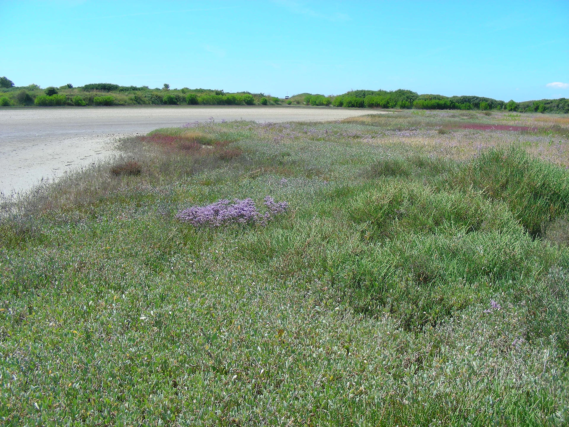
Atlantic salt meadows (Photo credit : Cap Atlantique)
Regarding fauna, these environments can host various bird species, such as the Bluethroat (Luscinia svecica namnetum) or the Meadow Pipit (Anthus pratensis) during the nesting period, duck populations (anatidae) (thanks to the presence of Glyceries (Puccinellia maritima) which are loved for example by brant geese (Branta bernicla) but also rodents, small carnivores feeding on worms, molluscs and insects as well as terrestrial predators found here These environments also constitute major areas for the growth of marine fish such as the Bass (Dicentrarchus labrax).
Regarding végetation, these environments are, depending on the topographic levels, dominated by the Grasses (notably Chiendent du littoral Elytrea… ..) or by the Obiones, Aster, Soda, Limonium, Common soda, Glyceria maritime… depending on their layering. You can also find endangered and protected plants: Cranson from England (Cochlearia anglica, protected at regional level) and common Statice (Limonium vulgare, regulated picking in certain departments including Loire-Atlantique, marketing prohibited in Vendée)
Protection status
Habitat listed in Annex I to the Habitats, Fauna and Flora Directive (1330: Atlantic salt meadows)
Distribution and state of conservation on Natura 2000 sites
This habitat is distributed over all the salt and salt marshes, mainly along the channel, on the dikes or in salt basins abandoned for many years.
In the LIFE Sallina territories, the salt meadows cover 10,918 ha, including 434 ha in the salt marshes of Guérande and Mès and 10,484 ha in the Breton Marsh and the island of Noirmoutier (awaiting updating of the mapping of habitats).
Conservation objectives / threats / actions planned in LIFE
At the marsh scale, the conservation objectives are aimed at maintaining the surface area of the habitat, both for its specificity and for its role in welcoming wildlife.
In exploited areas, the threats to these habitats are intensive maintenance practices which can lead to the disappearance of these pioneer habitats. In the sectors in decline, the threats are mainly the vegetable competition of Baccharis halimifolia, blackthorn. By competing with natural vegetation, these species degrade the conservation status of these habitats.
LIFE Sallina provides the restoration and improvement of the state of conservation of nearly 77 ha of salt meadows by brush cutting, fight against invasive species and grazing, as well as work with salt workers to promote saliculture practices allowing the maintenance of these habitats.
Why this habitat is targeted by LIFE
As a habitat of the Habitats, Fauna, Flora Directive and very localized on the scale of the European Atlantic coast, the territories of LIFE Sallina have a strong responsibility as for its preservation and the achievement of a good state of conservation required by the Directive (state of conservation on the scale of the European Atlantic coast considered “unfavorable – inadequate” for 50% of the total surface and “unfavorable-bad” for 41%.